Live Weather from WRUF-TV
Current Conditions
Weather Forecast from FPREN
Right Now
<%#if ../customizedJsData.conditionIcon%>
 <%precipitation.probability.value%><%precipitation.probability.units%>
Last Updated <%metar.updated%>
<%/each%>
<%precipitation.probability.value%><%precipitation.probability.units%>
Last Updated <%metar.updated%>
<%/each%>
Current Weather
<%#each items%>
<%metar.temperature.value%>°
Feels Like
<%metar.feelsLike%>°
<%metar.weatherCode.text%>
<%precipitation.probability.value%><%precipitation.probability.units%>
Humidity
<%metar.relativeHumidity.value%> <%metar.relativeHumidity.units%>
Dew Point
<%metar.temperature.dewPoint%>°
Pressure
<%metar.pressure.value%> <%metar.pressure.units%>
Winds
<%metar.wind.windDir%> <%metar.wind.windSpeed%> <%metar.wind.speedUnits%>
Hourly Forecast
Hourly Forecast
<%#each items%>
 <%forecastItemWind.windDir%> <%forecastItemWind.windSpeed%> <%forecastItemWind.speedUnits%>
<%/each%>
<%forecastItemWind.windDir%> <%forecastItemWind.windSpeed%> <%forecastItemWind.speedUnits%>
<%/each%>
<%formattedDateTime%>
<%forecastItemTemperature.value%>°
<%#if conditionIconUrl%><%forecastItemWeatherCode.text%>
7-Day Outlook
<%#each items%>
<%day.daytimeFromBaron.entryPrecipitation.probability.value%><%day.daytimeFromBaron.entryPrecipitation.probability.units%>
<%/each%>
<%#if day.daytimeFromBaron.conditionIcon%>
<%name%>
<%day.daytimeFromBaron.weatherCode.text%>
High
<%day.temperatureFromBarons.temperatureMax%>°
Low
<%day.temperatureFromBarons.temperatureMin%>°
Latest Weather News
-
 A plume of Saharan dust is set to arrive to Florida, causing the storm chances to drop and temperatures to soar. Let's talk about the dust!
 -
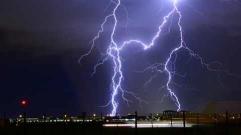 City of JacksonvilleMales and Florida lead the nation in lightning fatalities. Here are some lightning safety tips.


-
 A weak area of low pressure is meandering off the Southeast. Florida beaches could still see heightened surf and an increased risk of rip currents through the July 4th holiday.
 -
 In Florida, hurricane danger does not begin at landfall. Outer bands, tornadoes, and worsening travel conditions can start hours earlier, making timing one of the most important parts of storm preparation.
 -
 The remnants of a cold front could leave enough energy behind over the western Atlantic to ignite tropical storm activity east of Florida. What are the chances of this system developing, and where could it go?
 -
 Florida has historically seen limited tropical impacts during July. Tropical Storm Elsa impacted the region in 2021 and Hurricane Dennis made landfall in 2005.
 -
 Drought conditions are improving across many areas in Florida, but temperatures are about to soar, and chances of storms become more limited this weekend. Also, Saharan dust could be making the skies hazy.
 -
 A stationary front increases rain coverage across parts of Florida through the end of this week, while a high-pressure system builds just in time for the weekend, bringing temperatures near record heat or breaking records.
 -
 Florida officially entered astronomical summer on June 21, marking the longest day of the year.
 -
 On Thursday, temperatures were already hot across much of the Florida Peninsula, with roughly two-thirds of the state under a Heat Advisory. Not only were air temperatures high, but the combination of heat and humidity pushed heat index values as high as 110°F in some locations.
 -
 Tropical storm Arthur was short lived, lasting only about 6 hours. But forecasters are watching for increased flooding rain and storm chances across parts of Florida later this week.
 -
 Arthur became the first named system of the season, but in less than 6 hours after being named, it moved over land in Texas. The flash flood threat continues for the next couple of days across the Southeast.


