

Check out the forecast for Florida for Tuesday, November 3, 2026.
— Florida Public Radio Emergency Network (FPREN) (@FloridaStorms) November 2, 2026
A few showers will move across southeast Florida and into the Southwest during the day. Keep the umbrella handy! pic.twitter.com/um5BsFym0I
A soggy start to November brought heavy rain and thunderstorms across South Florida on Sunday, November 1, flooding streets and saturating ground in several communities. Unsettled weather is expected to continue Monday before conditions gradually improve Tuesday.
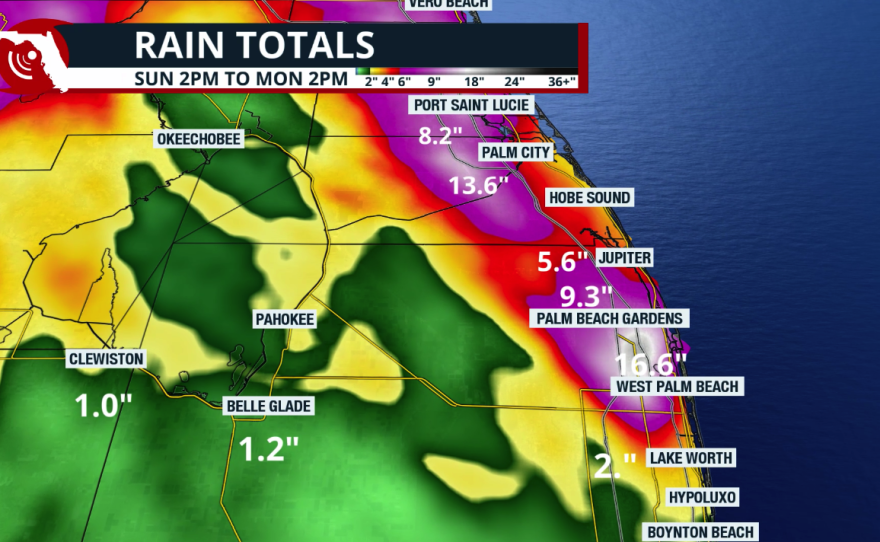
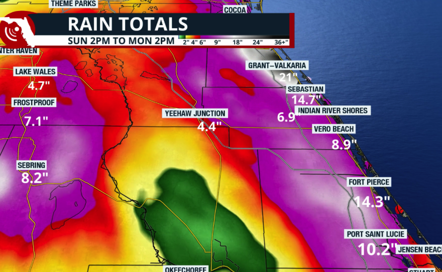
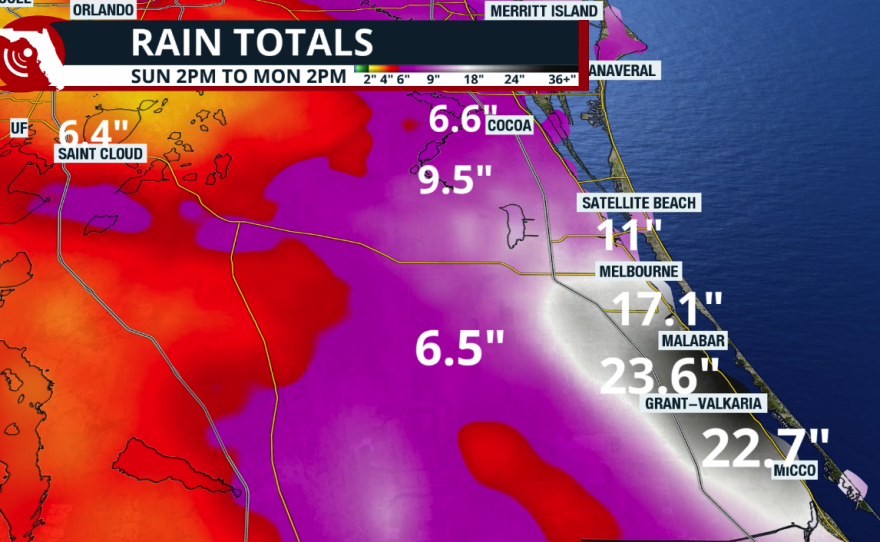
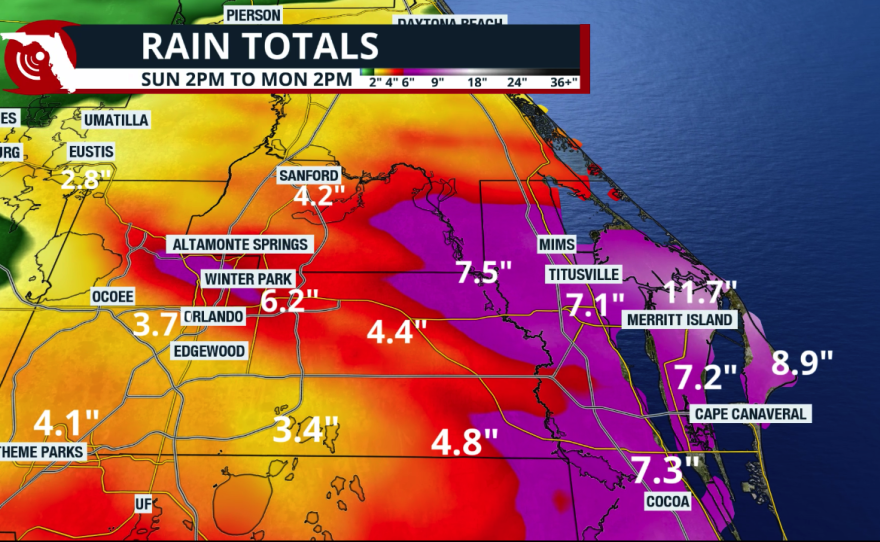
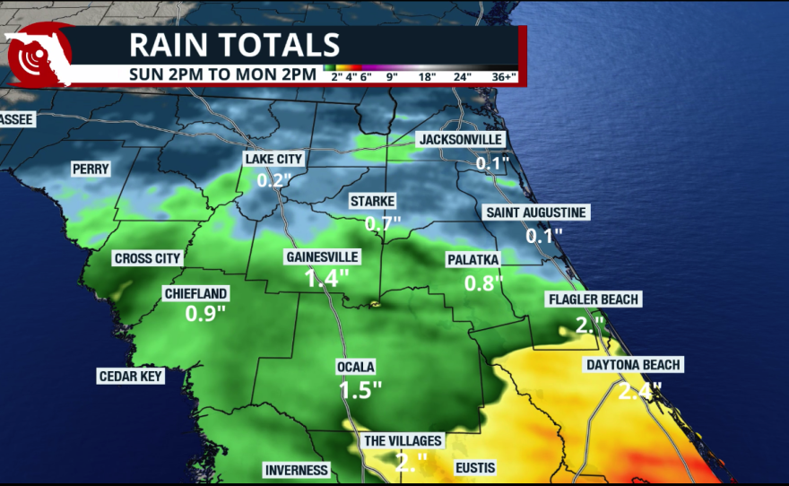
According to the National Weather Service in Miami, many locations along the southeast Florida coast and around Lake Okeechobee had already received 1 to 3 inches of rainfall by Sunday afternoon. Some of the highest totals fell farther inland, where isolated locations in Glades and Hendry counties recorded 4 to 6 inches. Other locations across the Treasure Coast, particularly in Palm Beach County, received more than a foot of rain. In fact, Palm Beach, Florida, registered a 1,000-year rain event after 17 inches fell in just 6 hours. This extremely rare rainfall event has only a 0.1% chance of occurring at a particular location in any given year.
‼️ 1000 Year Rain Event Exceeded by almost 2X in Palm Beach Florida!
— Jeff Berardelli (@WeatherProf) November 2, 2026
For at least the 3rd time in 3 days the US has had a 1000 year rainfall event, based on our historical climate. 17 inches in 6 hours in Palm Beach Gardens. Beats the criteria of 9” by 1.8X! Staggering.… pic.twitter.com/7k28p8uR8u
In Miami-Dade County, particularly intense thunderstorms produced estimated rainfall totals of 3 to 5 inches in some areas, prompting a flash flood warning Sunday afternoon. The rain let up Monday morning, but radar quickly became busy in the afternoon, and the National Weather Service issued a severe thunderstorm warning for North Central Miami-Dade County because strong winds of at least 60 mph are possible. The warning ended shortly after 4 p.m., but heavy rain continued across South Florida through the afternoon.
And if more than a foot of rain in Palm Beach (in 6 hours) wasn´t enough on Sunday, over 2 feet of rain fell near Melbourne on Monday. Endless rounds of heavy rain moving mainly from the south dropped more than 26 inches in 24 hours, but the rain has continued, and we have to wait until it stops to get the final number.
‼️ Flash Flood Emergency Continues
— Jeff Berardelli (@WeatherProf) November 2, 2026
In all my year’s as a Meteorologist, I’ve NEVER seen anything like this. Multiple cities have seen 12-24” of rain, without a Tropical Storm, and it just won’t stop. ~2 feet in Palm Bay & Melbourne.
As I write this torrential bands are setting… pic.twitter.com/5eiKROmQQ7
Totals registered at official stations across Florida cities on Sunday, November 1, 2026.
| City | Rainfall |
|---|---|
Miami | 1.57" |
Tampa | 1.47" |
West Palm Beach | 4.28" |
| Fort Lauderdale | 1.95" |
Sarasota | 0.72" |
Key West | 0.74" |
Tallahassee | 0.26" |
Fort Myers | 0.07" |
Orlando | 0.43" |
Pensacola | 0.03" |
Jacksonville | Trace |
Forecast for Election Day across Florida
On Tuesday, a few heavy showers and thunderstorms are still possible, most pronounced over South Florida. There is a marginal risk for flash floods on Tuesday from South Florida through the East Central Florida region.

South Florida: Expect a warm, humid Election Day with a mix of clouds and sunshine. Scattered showers could develop throughout the day, with highs near 86°F in Miami.
Central Florida: Expect a mix of sunshine and clouds, with occasional showers, especially late morning and afternoon. Temperatures will climb into the lower to mid-80s, with Orlando near 84°F.
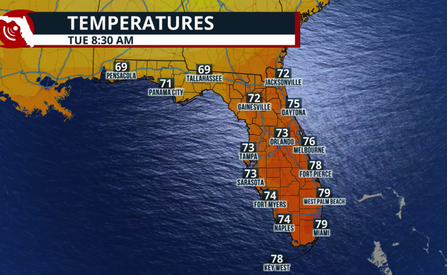
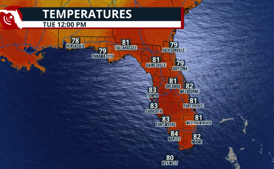
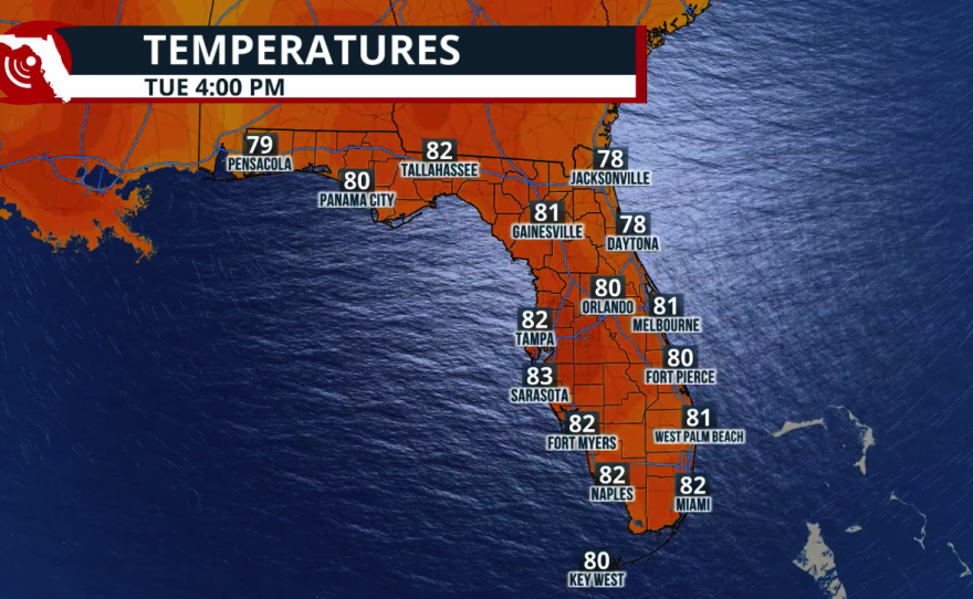
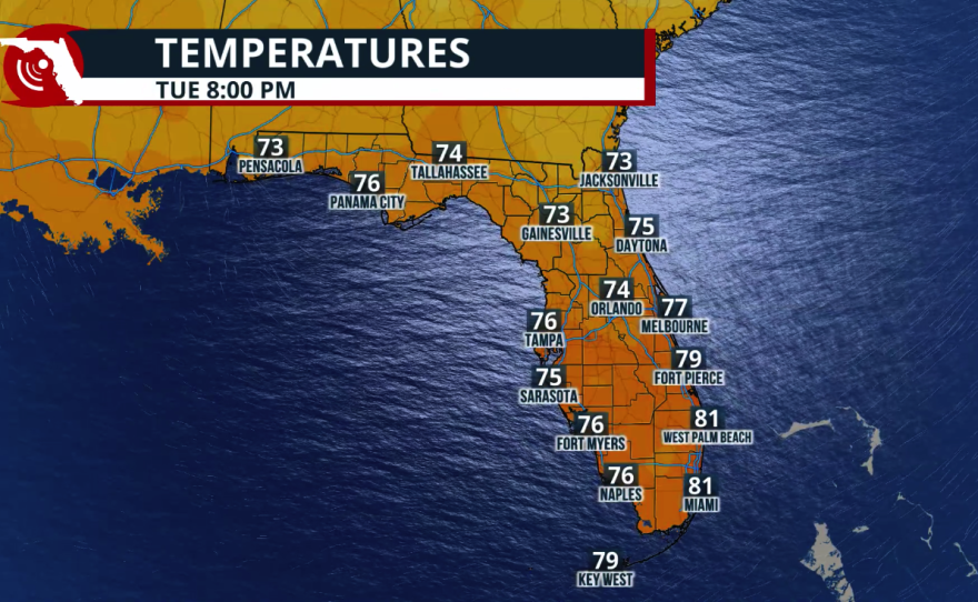
North Florida: Voters should expect a few passing showers, especially in the morning and early afternoon. Jacksonville will see periods of sunshine between showers, with highs near 82°F.
Florida Panhandle: Mostly cloudy skies will dominate Election Day, but much of the daytime should remain dry. Highs will reach the upper 70s, with rain chances increasing late Tuesday night.
