
A cold front has moved across the Florida Peninsula and is bringing unsettled conditions for Wednesday, mainly focused along the Space Coast through Jacksonville, including the eastern half of Central Florida. This front is weakening and becoming stationary just north of Lake Okeechobee. Meanwhile, South Florida is expected to remain mostly rain-free this week. This also means temperatures will remain above average for this time of year, staying in the low to mid-80s. Winds, mainly coming out of the south across the Keys and South Florida, will keep these warm temperatures in place.
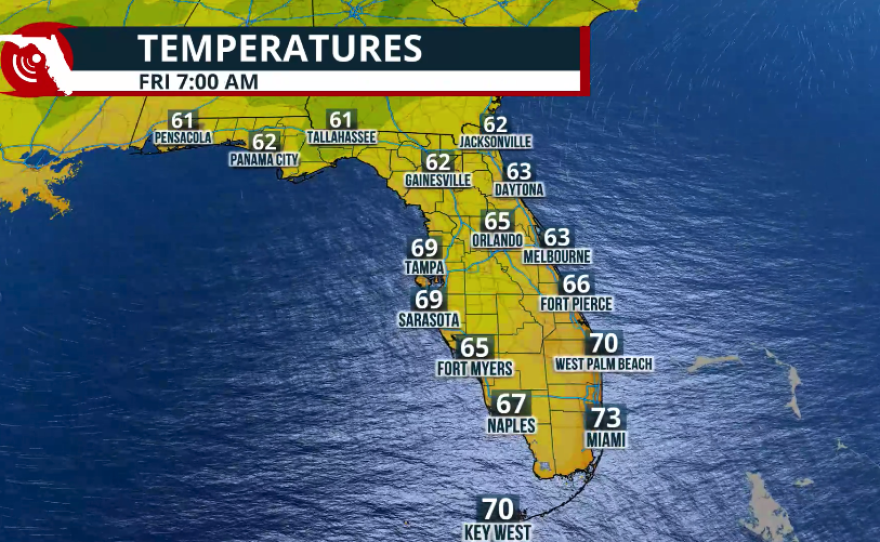
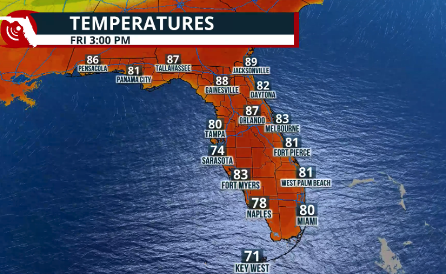
Across Central Florida, rain showers will continue to stream in on Thursday morning, mainly focused along the Space Coast. Other portions of Central Florida will experience more stable conditions on Thursday and Friday. Afternoon temperatures will be in the mid-80s, while evening temperatures will drop to the low 60s from Thursday night into Friday morning.


Across North Florida, temperatures on Wednesday will be slightly cooler than in the rest of the state, especially across the peninsula. Highs will be in the upper 70s, with a few more clouds present, mainly on Wednesday afternoon. Winds will be shifting, and gusts could still reach up to 20 mph. These gusts are likely to continue through the evening hours, then diminish by Thursday. Winds coming mainly from the east will keep North Florida, including Gainesville and Jacksonville, in the mid to upper 80s toward the end of the week.
As we finish off the workweek, a high-pressure system will settle across Florida. This will bring a shift in winds and warming temperatures across the entire Sunshine State. Temperatures will remain above average during both mornings and afternoons, staying about 3 to 5 degrees above normal for this time of year.

The Next Cold Front
As we move into late March, cold fronts become more scarce. However, another front is expected to push across the entire state on Sunday. This front is not expected to bring a drastic drop in temperatures, but it could increase the chances for showers, especially across the southern half of the peninsula. Due to increased cloud cover, Sunday will likely feature slightly cooler temperatures from areas just south of Orlando through South Florida.

One key factor to watch will be the winds. Winds are expected to increase significantly from Saturday evening into Sunday and Monday. After the front moves through, a high-pressure system will be centered over the Mid-Atlantic states. As a result, winds will not be primarily from the north on Sunday, but rather from the east. Strong winds will create hazardous marine conditions, especially along Florida's East Coast, where small craft advisories are likely. This will keep morning temperatures slightly above average for Sunday through Tuesday.
Afternoon temperatures on Sunday and Monday will remain slightly below average along the I-95 corridor, generally in the mid to upper 70s. Meanwhile, the Florida Panhandle will continue to experience above-normal temperatures even into the start of next week, as this cold front is not expected to bring significant changes to that region.

