
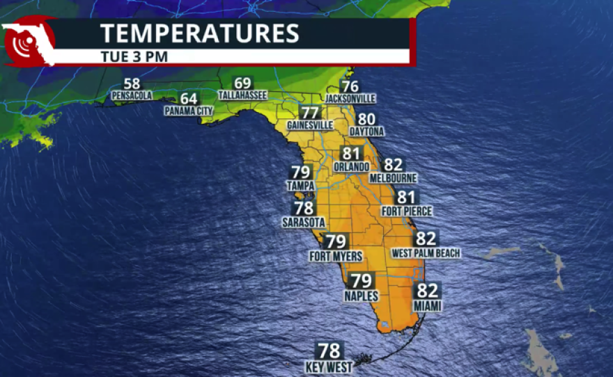
Florida will deal with two systems this week. These systems are very similar, but the latter one, arriving early in the weekend, seems to have more moisture packed in. There are still several days ahead, and we will continue to monitor it closely and provide updates as we fine-tune the forecast. Let's talk about the first system, a cold front crossing the northern portion of Florida between Tuesday and Wednesday, and the changes it could bring.

This cold front could continue to develop isolated storms, some of which could become severe, across the Panhandle from Tuesday morning onward. The Storm Prediction Center has issued a marginal risk for severe storms for a big chunk of the Panhandle, meaning some could become severe, with gusty winds of at least 58 mph as the primary risk.
Downpours move over the Panhandle from west to east. This front is losing its punch as it moves over North and then Central Florida on Tuesday. pic.twitter.com/bPBqYNHxO1
— Florida Public Radio Emergency Network (FPREN) (@FloridaStorms) December 2, 2025
The front will lose moisture as it travels south. This cold front is attached to a low-pressure system moving quickly across the Northeast, and it will pull the most frigid, driest air with it. Expect extremely dry air to take over the Panhandle and North Florida, likely lasting through Thursday, perhaps Friday.
Rainfall will range between 2 and 3 inches across parts of the western Panhandle and likely not reach half an inch over much of Central Florida. However, any isolated storm that develops over the area could drop slightly more than half an inch.
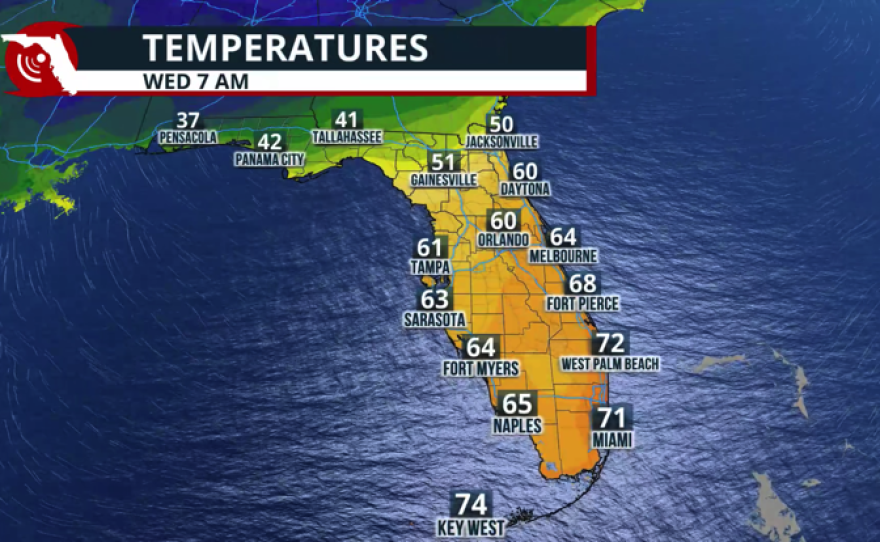
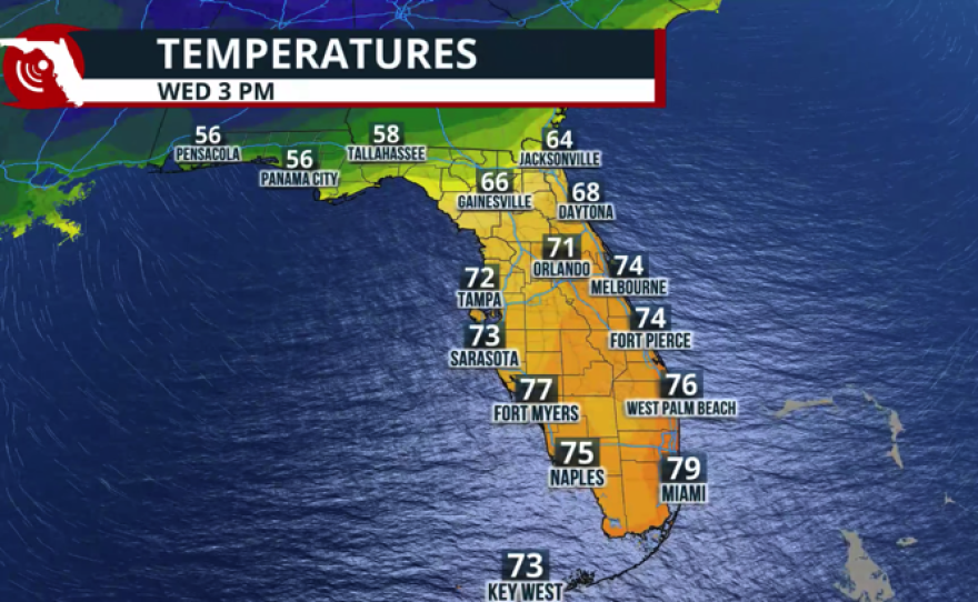
We forecast temperatures to be the coldest on Wednesday morning, dropping to the low-40s in the Panhandle and struggling to reach the mid-60s there on Wednesday afternoon as the cooler air filters through. Thursday morning will be another cold morning with lows in the low-40s.
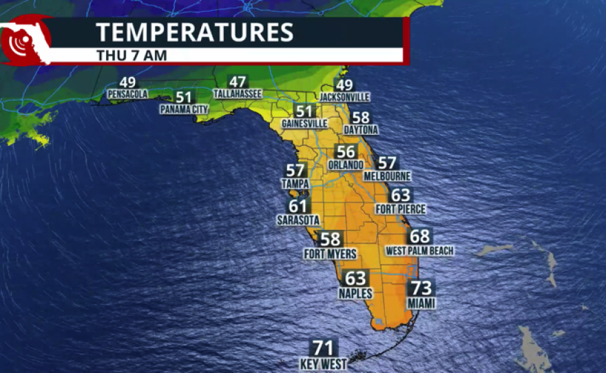
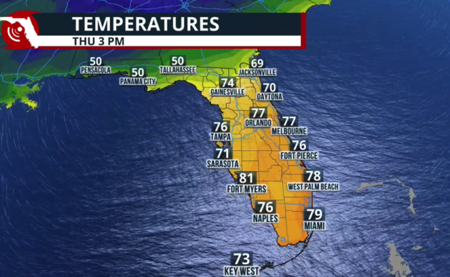

For Central Florida, Thursday and Friday afternoon will be in the low-70s, and late-week mornings will be in the 50s. But the winds will shift late week as another system, similar to the one that passed early week, arrives in the Panhandle. Expect a click warm-up for Friday into the weekend.
Overall, up to 3 inches of rainfall is possible, especially across the central and western portions of the Panhandle, with this system. The front, although it will continue to bring showers over North and Central Florida, will not come as loaded with precipitation; therefore, about 1 inch of rain is forecast.
