
Florida is expected to receive some much-needed rainfall at the start of this week. The state is currently experiencing its worst drought since records began in 2000. As April arrives, we are beginning to see a seasonal transition in rainfall patterns across the region.
Check it out, Florida! We will start the week with some rain (much-needed) as a cold front moves south slowly. Don't expect temps to drop; just expect instability to linger through the middle of the week. pic.twitter.com/8RZqkJlvHd
— Florida Public Radio Emergency Network (FPREN) (@FloridaStorms) April 5, 2026
Many areas across Florida are dealing with significant rainfall deficits. Locations from Tallahassee to Jacksonville have recorded deficits exceeding 12 inches over the past six months, with Tallahassee itself nearing a 10-inch shortfall during that same period.
April can sometimes bring surprises. While drought conditions have also expanded across South Florida, rainfall remains below normal here as well. Although March brought more rain than November, December, January, and February combined, the region is still running a deficit overall.
While the recent pattern has been overly wet... March's total rainfall is the real story in Fort Lauderdale. pic.twitter.com/coeMhOKT8E
— Ryan Phillips - NBC6 (@RyanNBC6) April 2, 2026
In recent years, South Florida has experienced notable torrential rain events. One of the most significant occurred in 2023, particularly in the Fort Lauderdale area. A slow-moving low-pressure system, combined with additional moisture from the Gulf of Mexico, led to extreme rainfall across eastern Broward County. Over a roughly 12-hour period, more than 25 inches of rain fell in Fort Lauderdale, with over 21 inches recorded in Dania Beach. This historic event caused severe flooding and forced the closure of Fort Lauderdale-Hollywood International Airport.
Events like this serve as reminders that, under the right atmospheric setup, conditions can quickly shift from severe deficits to significant surpluses. While a single torrential event can make a dent in drought conditions, consistent and steady rainfall is what’s truly needed for long-term relief—without triggering flash flooding.
When the ground becomes extremely dry, it hardens and loses its ability to absorb water efficiently. As a result, heavy rainfall over a short period cannot drain properly, increasing the risk of flash flooding.
North Florida Outlook
Across the Florida Panhandle, rainfall is expected from Sunday night through Monday afternoon. Showers will continue to move across eastern areas, including Tallahassee to Jacksonville, into Monday night.
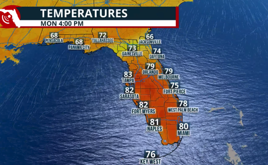
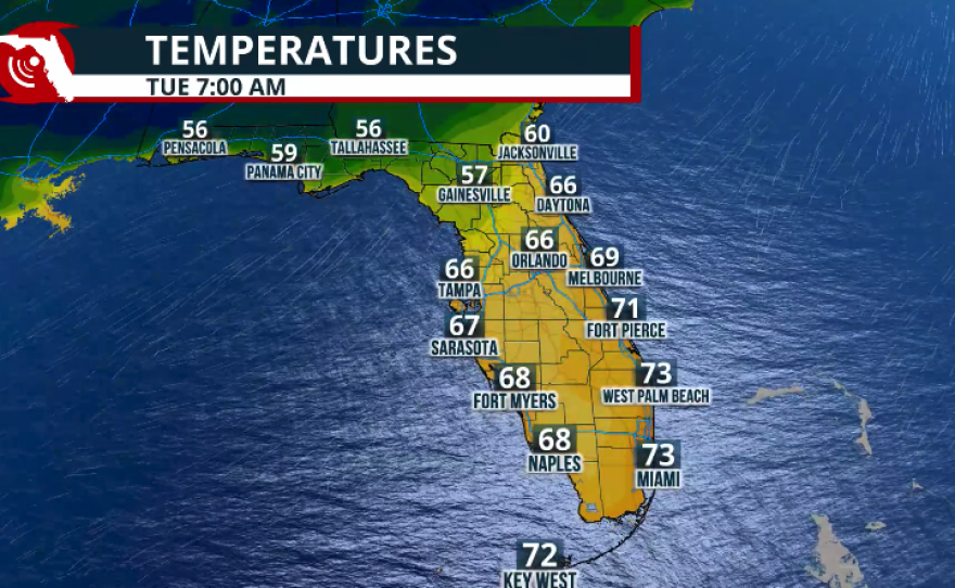
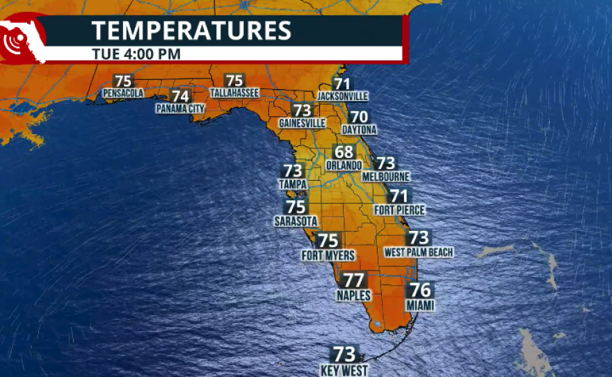
By Tuesday morning, rain should clear out along the I-10 corridor, with drier air moving in. This will limit additional shower development and bring more comfortable conditions. High temperatures are expected to reach around 80°F in Tallahassee, while Jacksonville will remain slightly cooler, in the low 70s.
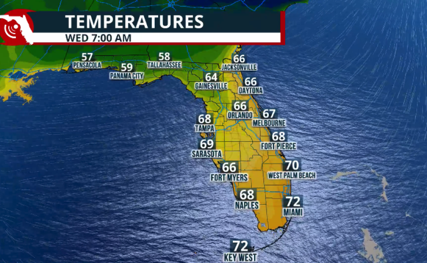
By Wednesday, a few showers may return, particularly in the afternoon, affecting areas between Tallahassee and Jacksonville.
