The Everglades, Fla – When construction first started on the plot of land just north of Everglades City in 1968, state officials had big plans.
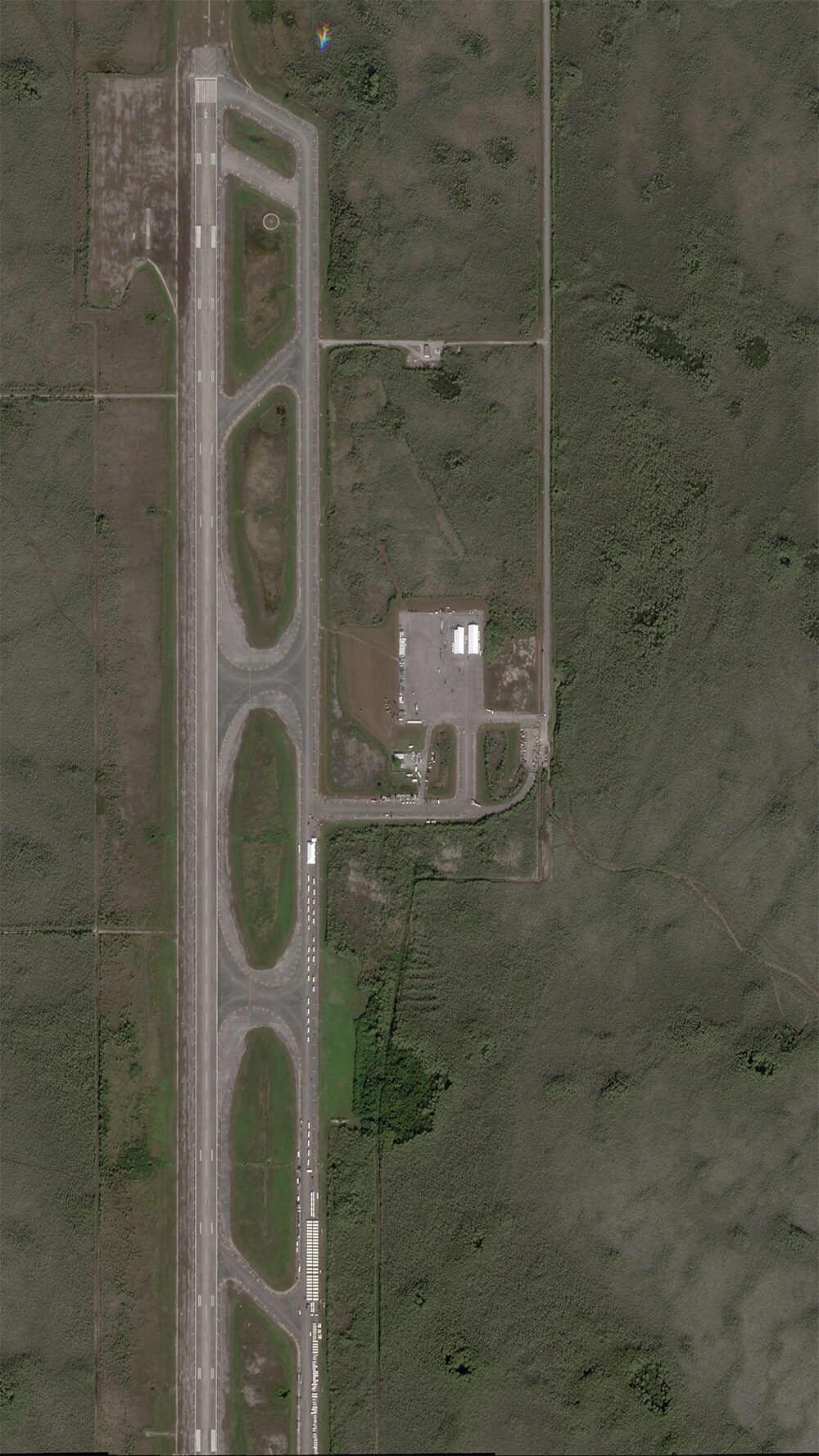
The site was set to transform into the largest airport in the world, Big Cypress Jetport. With plans for six runways spanning across 39 square miles, it would have measured about five times greater than New York’s JFK Airport.
But only one runway was built and it later shut down due to environmental concerns.
For over half a decade it lay essentially abandoned and forgotten, with nothing but an occasional airplane to show for its former glory.
Now, history could repeat itself and the site — now used as a detention and deportation site for undocumented immigrants — could lay empty once again, as hundreds of detainees were transferred out of the site following a district court judge ruling in late August.
A judge ordered the state to halt construction and influx of immigrants after monthslong legal efforts from environmental groups and representatives calling for the site’s shutdown.
Once the immigrants were transferred out of the site, commonly dubbed as “Alligator Alcatraz,” their status was unknown. Almost two-thirds of the over 1,000 estimated detainees held inside disappeared, with no record of them on ICE’s online database, according to the Miami Herald.
As for the current status of the legal battle, Kevin Guthrie, the DeSantis-appointed executive director of the Florida Division of Emergency Management, appealed the case to be heard in the federal appeals court in Atlanta.
How did we get here?


After eight days of construction in late June, the site began to transform into the nationwide controversy and the heart of Florida's deportation efforts.
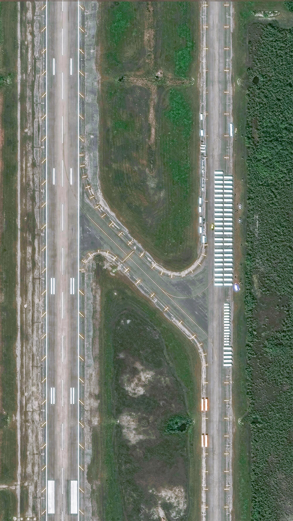
When Attorney General James Uthmeier announced the site’s construction plan on June 20, the site lay barren. Four days later, Maxar Technologies satellite images show almost 100 white tents dotted the worn, concrete surface of the airstrip while the occasional car or semi trucks parked along the two-mile entrance of the airport.
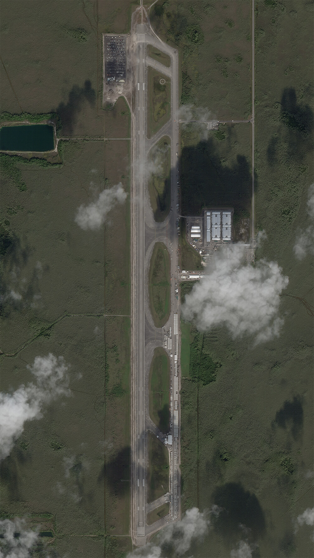
By late July, Planet Labs satellite images captured showed the site had almost doubled in volume.
Once empty lots became filled with additional white tents and buildings to hold detainees. The few vehicles previously parked carelessly along the green grass lining of the airstrip turned to hundreds parked together in organized lots. Miscellaneous items lined the paved areas, while the airstrip crowded with activity.
And to expand construction, environmental groups say Kevin Guthrie and organizers of the site paved over a preexisting dirt lot estimated to be 11 plus acres Southeast of the airstrip.
The Center for Biological Diversity and Friends of the Everglades added their suspicions to a lawsuit against Guthrie and cited photographs from private pilot Ralph Arwood, which showed what he said appears to be a dark, black square, which he said was “almost certainly asphalt,” in his declaration to the court.
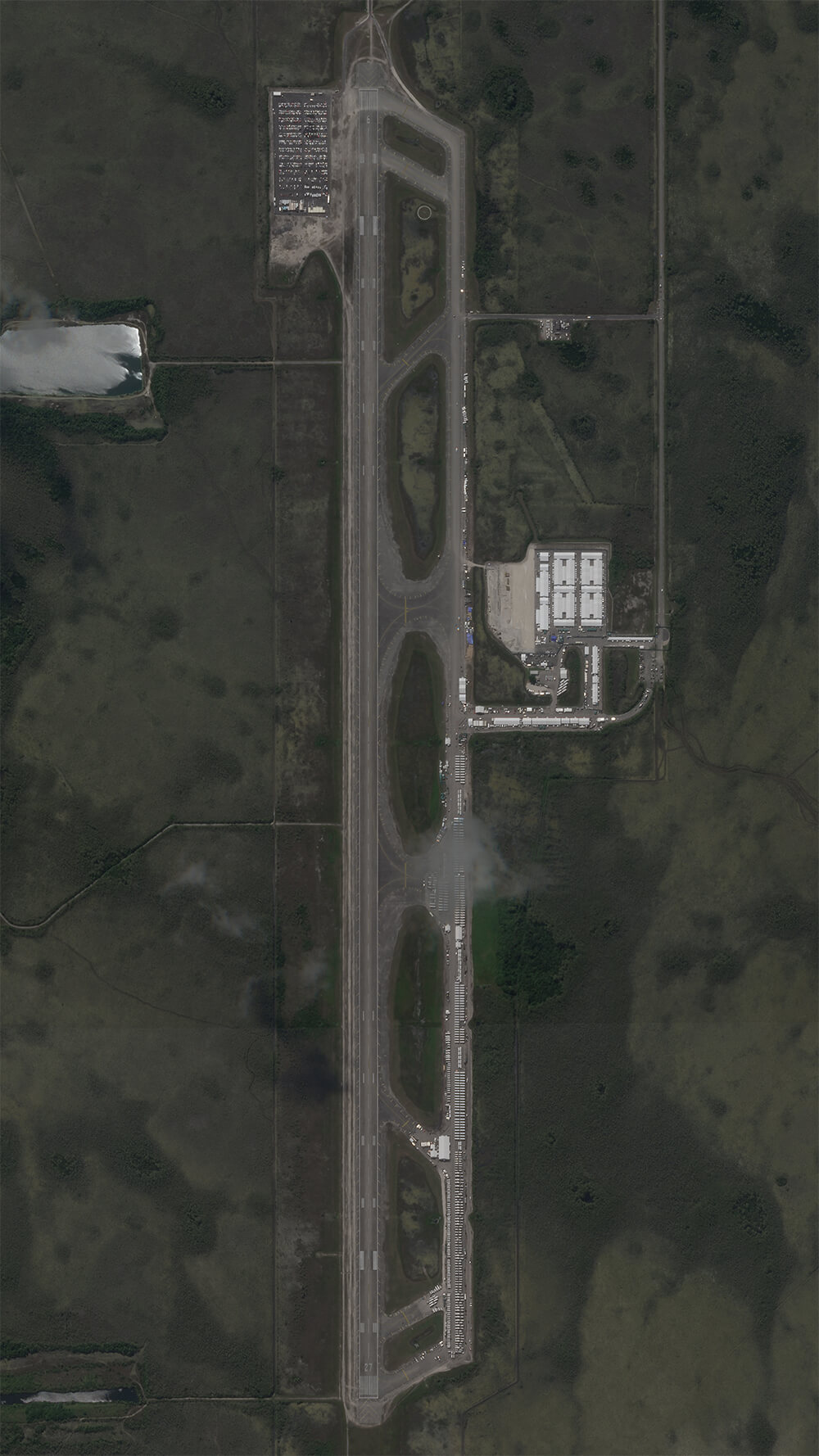
He said it was a stark difference from the light, sandy brown color it was in previous photos. Planet Images satellite images taken in July and August show the same — the lot once a light sandy brown turned black.
While he didn’t deny the paved construction, Guthrie filed a response and said any paving that took place was small scale. “The photos confirm Defendants’ position that the project is taking place within the existing footprint of a working airfield,” Guthrie’s response said. “The fact that Plaintiffs quibble with relatively minor paving projects significantly undercuts their claimed irreparable harm.”
Zoom back out and flash forward a month later, Planet Images’ most recent satellite image taken on Aug. 21 shows the runways as unrecognizable, overrun by a sea of white tents stretching across the two mile asphalt.
Satellite Imagery: A New Frontier
Maxar Technologies, one of the satellite image capturing companies depicting the site, can capture high-resolution detail down to the front windshield of a car. It uses its 10 current orbiting satellites — all of which are about 400 miles away — to allow viewers to see the most up close and transparent image.
With the images at 30 centimeter resolution, that means seeing details like explosions, fires or mass activity which normal satellite images are usually unable to capture, the company’s senior director, Stephen Wood said. The satellites can also capture details like individual military equipment, he said, which becomes useful in alerting the public to war invasions.
“We can't see who a person is based on the imagery, but we can see people, especially when they're out together in a crowd and things like that,” he said. “We can see the windshield of a car. We can see the home field or the home plate on a baseball field.”
One of the biggest differences from Maxar satellites to others: its size.
Satellites like Terra Bella or BlackBridge, both owned by Planet Labs, another leading satellite imagery company, are shorter in height than an average 5 '8 person. Maxar’s satellites are more than three times that, and can best be described as the size of a Chevy Suburban, Wood said.
“They're not tiny little shoe boxes by any means,” he said. “The resolution is the best you can get.
Satellite imagery companies like Maxar are usually employed for high-interest events, he said, including the construction of “Alligator Alcatraz.”
“It was being widely reported in the press and people began coming to us and saying, ‘Can we see it,’” he said. “Just to give that perspective of what it looks like.”

