
Live Weather from WRUF-TV
Current Conditions
Weather Forecast from FPREN
Right Now
<%#if ../customizedJsData.conditionIcon%>
 <%precipitation.probability.value%><%precipitation.probability.units%>
Last Updated <%metar.updated%>
<%/each%>
<%precipitation.probability.value%><%precipitation.probability.units%>
Last Updated <%metar.updated%>
<%/each%>
Current Weather
<%#each items%>
<%metar.temperature.value%>°
Feels Like
<%metar.feelsLike%>°
<%metar.weatherCode.text%>
<%precipitation.probability.value%><%precipitation.probability.units%>
<%precipitation.probability.value%><%precipitation.probability.units%>
<%precipitation.probability.value%><%precipitation.probability.units%>
Humidity
<%metar.relativeHumidity.value%> <%metar.relativeHumidity.units%>
Dew Point
<%metar.temperature.dewPoint%>°
Pressure
<%metar.pressure.value%> <%metar.pressure.units%>
Winds
<%metar.wind.windDir%> <%metar.wind.windSpeed%> <%metar.wind.speedUnits%>
Hourly Forecast
Hourly Forecast
<%#each items%>
 <%forecastItemWind.windDir%> <%forecastItemWind.windSpeed%> <%forecastItemWind.speedUnits%>
<%/each%>
<%forecastItemWind.windDir%> <%forecastItemWind.windSpeed%> <%forecastItemWind.speedUnits%>
<%/each%>
<%formattedDateTime%>
<%forecastItemTemperature.value%>°
<%#if conditionIconUrl%><%forecastItemWeatherCode.text%>
<%forecastItemPrecipitation.probability.value%><%forecastItemPrecipitation.probability.units%>
<%forecastItemWind.windDir%> <%forecastItemWind.windSpeed%> <%forecastItemWind.speedUnits%>
7-Day Outlook
<%#each items%>
<%day.daytimeFromBaron.entryPrecipitation.probability.value%><%day.daytimeFromBaron.entryPrecipitation.probability.units%>
<%/each%>
<%#if day.daytimeFromBaron.conditionIcon%>
<%name%>
<%day.daytimeFromBaron.weatherCode.text%>
<%day.daytimeFromBaron.entryPrecipitation.probability.value%><%day.daytimeFromBaron.entryPrecipitation.probability.units%>
High
<%day.temperatureFromBarons.temperatureMax%>°
Low
<%day.temperatureFromBarons.temperatureMin%>°
Latest Weather News
-
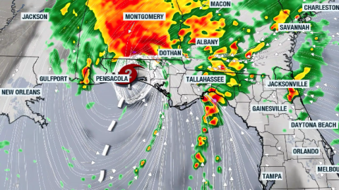 Damaging winds, tornadoes, and flash flood risk will continue throughout the weekend across the Southeast into the Mid-Atlantic.
 -
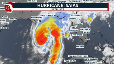 Numerous damaging tornadoes are possible even after the hurricane moves inland and weakens; the heavy rains will continue throughout Saturday morning across the Florida Panhandle. (Version in Spanish here, too)


-
 Tropical Storm Isaias is expected strengthen into a Category 2 hurricane on Friday. The cyclone is headed towards the northern Gulf but moisture will impact much of Florida.
 -
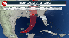 Florida faces continued heavy rain and flooding concerns as the strengthening tropical system moves toward the northern Gulf Coast, with landfall possible late Friday or early Saturday.
 -
 A strengthening El Niño could bring Florida a wetter, cloudier and stormier dry season. Here is why the risk of flooding, squall lines and tornadoes typically increases—especially across Central and South Florida.
 -
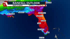 Gradual development is possible this week, but it will likely take the whole week for anything to develop. Rain across Florida this week is due to a front and local effects.
 -
 Water restrictions remain in effect in Alachua County despite a wetter August, as groundwater levels continue to lag after months of below-average rainfall.
 -
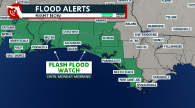 Tropical downpours are expected this weekend across the western Florida Panhandle. Local flash flooding will be possible
 -
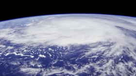 The Atlantic has produced eight named storms in 2026—but no hurricanes. Here is how a strengthening El Niño helped create the historic lull and why the season’s shift toward the Caribbean and Gulf still matters for Florida.
 -
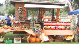 October weather across Florida is usually warm, with lower precipitation chances. The tropics usually remains a concern through the month.
 -
 Florida finally has a meaningful opportunity to put a dent in its drought, but the same prolonged wet pattern that brings drought relief could also bring localized flooding and increasingly rough coastal conditions into next week.
 -
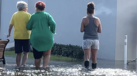 King tides flooded roads, businesses and the Hollywood Beach Broadwalk across South Florida. Here is how the moon, warm water, onshore winds, porous limestone and a strengthening El Niño can combine to make Florida’s seasonal flooding worse.


